
Four unforgettable days of fun and good food. The route retraces the steps carried out by Rocco Papaleo in the movie "Basilicata coast to coast", through landscapes like Maratea and Sapri, and great history countries as Aliano. We will have time to visit such wonders as the sanctuary of Viggiano, with its Black Madonna, or the remains of the center of Craco, the ghost town abandoned after the events of the '60 landslide.
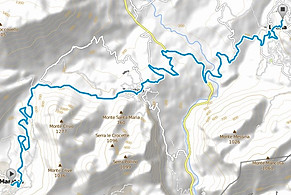
Day 1
Path: Medium difficulty
Distance: about 63 Km.
Difference in altitude: about 1030 mt.
Journey time: about 4 hours (excluding visits).
Journey time whit stops: about 5 hours (including visits).

Point of interest:
Maratea: "Maybe in Italy there aren't more superb scenery and views. Imagine dozens and dozens of kilometers of rugged cliffs with caves, rocks and smooth beaches in front of the most spectacular of the seas, now opened wide and open, now closed as sparse small docks. Separed by a dolomitic chain, all flesh-colored rocks, dotted with semi-abandoned villages, crumbling castles and ancient Saracen towers, a wooded slope passed by rivers and streams and buried under the foliage of oaks and chestnut trees. »
(Indro Montanelli)


Maratea is the only municipality of the province to look out over the sea, stretching for about 32 km on the Tyrrhenian Sea. Its coast, set in a unique geographical and environmental location , is variegated of inlets and caves, rocks and shallows.
Numerous and characteristics coastal beaches, which one faces the island of Santo Janni.
Worthy of attention are the seabed and 131 marine and land caves, some of which have yielded fossils and prehistoric artifacts. On all stands the Cave of Marina with stalactites and stalagmites.
In addition, the mountains inland, arriving with their ridges on the sea, creating a strong visual contrast of sea and mountains, that gives life to picturesque views and visual views.
Lauria: Natural reference center of a very large territory, corresponding to the historical region of south-western Lucania, Lauria is the biggest and most populated center of the Basilicata Tyrrhenian coast. Its geographical location, in a narrow transit area between Campania and Calabria, favors trade and migration flows through the territory. It was, in the Middle Ages, the county and bishopric de facto, with an evolution both demographic and institutional, similar to that of Matera. The city had a dramatic setback in the course of its history with the massacre of Lauria in 1806, due to an unfortunate incident that led Lauria, seat of the powers that be, to become a place of stubborn resistance against the Napoleonic Bourbon Advanced.


The consequences of this bloody repression were serious for the city: in addition to the devastating fire and the loss of the citizen archive, it worked the transfer of all state aids (hospital, court and law enforcement) to the minor centers neighboring ( Lagonegro and Trecchina). However, due to the geography of the city, to its territorial size, to a long and esteemed tradition of trade, entrepreneurship and labor, the inevitable slow recovery of some local government functions, it is now the most populous area. The presence of a large number of inhabitants in rural areas, much more populated than the city center, makes the entire municipality almost entirely man-made.
In the old town, which reveals typical signs of medieval times, with houses clinging to the hillside, open characteristic corners and the winding alleyways and narrow streets that create arches, underpasses, porches and warm and harmonious architectural motifs. The lauriotan territory, one of the greatest of Basilicata, offers a succession of picturesque rural, natural and artificial landscapes: the peaks of the massif of Sirino (the highest, the Mount Papa, reaches 2005 meters), snow-covered for much of year; the artificial lake of Cogliandrino; Round Lake; fresh sources of Sinni and Fiumicello; The Bosnian pine Serra Spina mountain; Castle Seluci (Latin: Seleuci) in the district where were unearthed archaeological finds and identified oil fields.

Day 2
Path: Medium difficulty
Distance: about 61 Km.
Difference in altitude: about 1400 mt.
Journey time: about 5 hours (excluding visits).
Journey time whit stops: about 6 hours (including visits).


Point of interest:
Tramutola: The Tramutola origins are very old and are linked to the arrival of the Benedictine monks in the area, though some theories it's known that a group of rejected by the nascent civilization paternese (from the ancient Civitas) sought protection in the throat where it is located currently the country. In 1144, a priest of the Abbey of Cava, John of Marsico chaplain abbot Falcone, who had not forgotten his native lands, attracted the sympathy of some rich people who donated to Cava Badia the St. Peter's church with dorm and all his possessions. The donation was perfected, as provided to the custom of the times, from Marsico Giovanni II consent of the bishop.


These buildings, perhaps founded by the Basilian had reached a certain importance because of way station on the road - or should say a tratture - that Atena Lucana through Brienza, leading to Marsico. To waive its rights, the marsicana diocese obtained a pound of wax, an incense and a pig year.
The presence of oil in the town was already known in the past, at least from the period around the mid-nineteenth century, as the geographer Amati signals its exploitation through the asphalt mines in the municipality, confirming what was reported in the "Annals of the Kingdom of the Two Sicilies "citing the exposure of asphalt samples of Marsico and Tramutola" to public arts exhibition and manufacture of 1853 "
Day 3
Path: Medium difficulty
Distance: about 61 Km.
Difference in altitude: about 930 mt.
Journey time: about 5 hours (excluding visits).
Journey time whit stops: about 6 hours (including visits).


Point of interest:
Viggiano: Italian town of 3,329 inhabitants located along the western ridge of Val d'Agri in the western part of the province of Potenza in Basilicata at an elevation of 948 m s.l.m. It is known for its long tradition of folk music and, in particular, the construction of harps. Viggiano was for centuries the origin place of many itinerant musicians who exported their music and traditions around the world, helping financially their country of origin, and many of them had the opportunities of staying in international symphony orchestras .
As a religious center houses the shrine of the Black Madonna, which is one of the spiritual centers and most important Marian faith of the South. It is also known as the place of extraction and refining of oil and the presence of the largest oil platform in Europe, which contributed largely to making Italy the third largest oil producer in Europe, after Great Britain and Norway.

Black Madonna of Viggiano's Sacro Monte church: presumably it was built in the fourteenth century, in the place where legend tells about the discovery of the statue of the Madonna. Legend has it that the sacred image was venerated since the dawn of Christianity in the ancient city of Grumentum; when it was destroyed by the Saracens, the statue was hidden in a hole, still visible behind the high altar and found thanks to the appearance of mysterious fires. The first known document that mentions the church dates back to 1393: it is an act in which Thomas Bono Iurno of Viggiano gave to the church ten beads pro Luminaris.
According to historians Giovanni Colangelo, Nicola Tommasini and Giovanni Tramice, the worship of the image of the Virgin was already widespread in the sixteenth century and was also in charge of the sanctuary Pope Julius II.
The ad limina visit, dated November 9, 1618, the bishop of Marsico Nuovo period, Msgr. Timothy Caselli, shows that the sanctuary of Santa Maria del Monte was argued with their income.


In 1890, Pope Leone XIII crowned the Madonna of Viggiano's Mount "Patroness and Queen" of Lucania. The investiture was reaffirmed by Pope Paolo VI in 1965: "It is known that in the territory of the diocese of Potenza and Marsico there is a Holy Temple, almost august palace, dear to all the people of Lucania, dedicated to the Blessed Mother of God Maria SS.ma of Viggiano's Mount. In fact, there is the venerable statue image for antiquity and beauty of the August Virgin, regent of the Child Jesus; this simulacrum, as it is insured, was found miraculously indicated by a heavenly flame, the close Mount, which is among the highest mountains of Lucania; and Maria SS.ma under the same title, given to you and to the temple together and the place was always proclaimed and venerated as the whole region Patroness and Queen '
In December of 1965 Pope Paolo VI elevated the sanctuary to the dignity of minor basilica.
In his autobiographical novel "Christ Stopped at Eboli", the writer Carlo Levi describes the procession of the Madonna of Viggiano. The statue was carved in the sixth century to be hosted in Grumentum cathedral.

Aliano: Perched on a clay hill at 555 m s.l.m., overlooking the Val d'Agri and the stream Sauro in the central-western part of the province, and at the border on the central-eastern province of Potenza. In its territory there are many gullies. It is bordered on the north by the municipalities of Stigliano (14 km) and Gorgoglione (20 km), on the east with Sant'Arcangelo (PZ) (17 km), on the south by Roccanova (PZ) (21 km) and west with Missanello (PZ ) (14 km). It is part of the Montana Matera Hills. Is 94 km from Matera and 83 km from Potenza.
The gullies of Aliano: The gullies are a geomorphological phenomenon of soil erosion that occurs due to the effect of run-off water of degraded shales, with poor vegetation cover and therefore not protected by the runoff.

Day 4
Path: Medium difficulty
Distance: about 74 Km.
Difference in altitude: about 530 mt.
Journey time: about 6 hours (excluding visits).
Journey time whit stops: about 8 hours (including visits).


Point of interest:
Craco: Craco (Cracum or Graculum in Latin) is an Italian town of 762 inhabitants in the province of Matera, Basilicata.
In the sixties, the old town has experienced an evacuation that made it a veritable ghost town. However, this phenomenon has helped make particular the village of Craco, and this feature has it become a tourist destination and a movie set for several films. It's located in the hills above the Lucanian Apennines at about 390 m s.l.m., halfway between the mountains and the sea, in the central-western part of the province. There are vary type of territories, with a predominance of the gullies, deep grooves cut in a chalky soil from the downhill run of rainwater. Because of a landslide of vast proportions, in 1963 Craco began to be evacuated and the inhabitants moved to the valley in "Craco Peschiera." Then the center had almost 2,000 inhabitants.


The landslide that forced the population to flee their homes seems to have been provoked by works of infrastructure, sewer and water systems, in service of the town. In 1972 a flood further worsened the situation, preventing a possible repopulation of the historic center, and after the earthquake of 1980 Craco old was completely abandoned. In spite of this forced exodus, Craco remains intact, becoming a ghost town. In 2010, the village has entered in the list of monuments to be safeguarded drawn up by the World Monuments Fund. The town, in the implementation of a recovery plan of the village, has been setted up, since the spring of 2011, for a guided tour route, along a made safe route, which allows you to walk the main street of the town, to get at what remains of the old main square, sunk following the landslide. In December 2012, a new route was opened, which leads into the core of the ghost town.
Cost per person *:
-low season € 870,00
-high season € 955,00
Minimum number of participants: 6/7
Services included:
-
Guide;
-
Bike;
-
Safety helmet;
-
Lunch box;
-
Shuttle with technical support;
-
Nights in hotels with half board treatment.
Not included services:
-
Admisson to museums.
Supplements:
-
e-bike € 20,00 / day
Transfer by private shuttle from Naples to Maratea and from Scanzano Jonico to Naples on request
Customized tours on request.
*booking and more info send an email to: info@irentbike.com
**for this tour, I Rent Bike gives you a trekking bike, flowing and comfortable for long routs with mixed path
